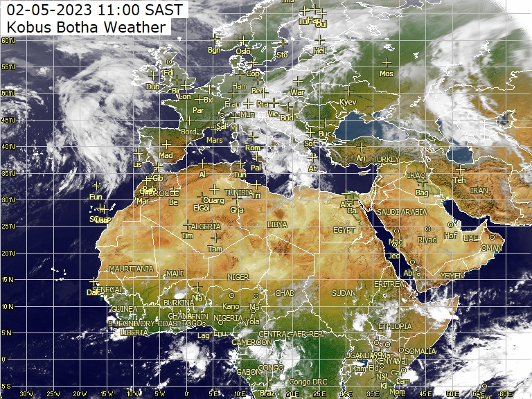
بسم الله الرحمن الرحيم السلام عليكم ورحمة الله وبركاته هذه مجموعة مواقع طقس هديه مني لكم وايضا هذا المواقع تحمل نماذج كثيره لخرائط الطقس المتعدده وكل ما تتمناه سوف تجده بهذا المواقع http://www.crownweather.com/?page_id=3413 http://www.crownweather.com/?page_id=29 http://www.metbrief.com/tropicalstorms.html http://www.crownweather.com/?page_id=13 http://www.metbrief.com/ http://www.woksat.info/wwp3.html http://www.woksat.info/wwp.html http://www.woksat.info/etcte09/indexte09.html http://www.woksat.info/wwp2.html http://www.woksat.info/etcte10/indexte10.html http://www.woksat.info/wos.html http://imkhp2.physik.uni-karlsruhe.d...r/archive.html http://imkhp2.physik.uni-karlsruhe.d...tbilder_e.html http://iridl.ldeo.columbia.edu/SOURC...0&my.help=plot http://www.nrlmry.navy.mil/NEXSAT.html http://www.nrlmry.navy.mil/nexsat-bi...®ION=AFRICA http://www.nrlmry.navy.mil/htdocs_dy...ity_zooms.html http://www.nrlmry.navy.mil/sat-bin/conus.cgi http://www.nrlmry.navy.mil/sat-bin/composite2.cgi http://www.nrlmry.navy.mil/sat-bin/over.cgi http://www.nrlmry.navy.mil/sat-bin/cloud_winds.cgi http://www.nrlmry.navy.mil/sat-bin/color_composite.cgi http://www.nrlmry.navy.mil/training-bin/training.cgi http://www.nrlmry.navy.mil/sat-bin/global.cgi http://www.nrlmry.navy.mil/tropics-bin/tropics.cgi http://www.nrlmry.navy.mil/sat-bin/clouds.cgi http://www.nrlmry.navy.mil/sat-bin/rain.cgi?GEO=africa http://www.nrlmry.navy.mil/sat-bin/rain.cgi http://www.nrlmry.navy.mil/sat-bin/long_movies.cgi http://www.nrlmry.navy.mil/sat-bin/cloud_tops.cgi http://www.nrlmry.navy.mil/ http://weather.utah.edu/ http://www.atmos.utah.edu/ http://weather.utah.edu/index.php?ru...s004&r=NH&d=DT http://amsu.cira.colostate.edu/ http://www.star.nesdis.noaa.gov/corp...spps/main.html http://www.ssd.noaa.gov/ http://amsu.cira.colostate.edu/ http://amsu.cira.colostate.edu/GPSTPW/default.htm
CIRA Experimental Merged Total Precipitable Water Products http://www.osdpd.noaa.gov/bTPW/ http://gpsmet.noaa.gov/test/index.html http://www.cira.colostate.edu/research/doc_noaa/ http://www.cira.colostate.edu/ http://www.rap.ucar.edu/weather/ http://www.dickgilbert.com/coloradocams.htm http://bcn.boulder.co.us/weather/center.html http://www.usgs.gov/natural_hazards/ http://www.meteociel.fr/modeles/gfse_cartes.php?ech=108 l wikipedia.org/wiki/Global_Forecast_System http://www.netweather.tv/index.cgi?action=nwdc;sess= http://www.weather.gov/mdl/forecast/graphics/MET/ وهذا GFS مميز http://theweatheroutlook.com/twodata/datmdlout.aspx Golden Gate Weather Service - NCEP Loops Page ايضا هذا مميز http://ggweather.com/links.html http://www.wrh.noaa.gov/mtr/mesonet/ http://www.txtornado.net/weather.htm http://www.westwind.ch/?name=xgfs http://www.lightningwizard.com/maps/ http://www.essl.org/ESWD/ http://www.spc.noaa.gov/exper/mesoanalysis/ http://oiswww.eumetsat.org/IPPS/html/MSG/RGB/ http://www.sat.dundee.ac.uk/demo.html http://weather.uwyo.edu/upperair/africa.html http://www.inntranetz.at/wetterbericht-archiv.html http://www.windguru.cz/int/help_index.php?sec=models http://www.ecmwf.int/products/foreca...!2010123100!!/ http://www.wunderground.com/modelmap...=GFS&domain=ME http://www.ecmwf.int/products/foreca...!2008122800!!/ http://wxweb.meteostar.com/models/ http://www.ncms.ae/gmodel/disp4.asp?...precipitation/ http://www.pakmet.com.pk/ http://en.allmetsat.com/images/met5_cimss_irc.php http://www.aemet.es/es/portada http://en.allmetsat.com/ http://www.ssec.wisc.edu/data/geo/ http://weather.msfc.nasa.gov/GOES/ http://wxmaps.org/pix/soil9.html http://wxmaps.org/pix/NHanim.html http://wxmaps.org/pix/hemi.00hr.html http://eol.jsc.nasa.gov/sseop/Clickmap/ http://www.yr.no/place/United_Arab_E...anced_map.html http://weather.ninemsn.com.au/models...h=168&focus=mh http://en.allmetsat.com/images/asia.php http://weather.myfoxtampabay.com/map...caribbean.html http://forecast.uoa.gr/forecastnew.php http://www.weather.uwyo.edu/models/fcst/ مميز جدا http://www.ogimet.com/tabla_predTN.phtml?lang=en http://weather.cod.edu/forecast/ http://www.met.sjsu.edu/weather/mode...avn_drift.html http://www.met.sjsu.edu/weather/weather.html http://www.met.sjsu.edu/links/ http://www.wetterzentrale.de/topkarten/tkavnafr.html http://7timer.y234.cn/V3/product.php...n&product_id=2 http://www.stormsurf.com/mdls/menu_wx.html وهذا متعدد ورائع ومميز ايضا http://www.coaps.fsu.edu/~maue/weather/
http://www.nco.ncep.noaa.gov/pmb/nwp.../model_m.shtml http://www.nco.ncep.noaa.gov/pmb/nwp.../model_s.shtml http://www.nco.ncep.noaa.gov/pmb/nwprod/analysis/ http://www.meteogroup.co.uk/uk/home/.../gfs-ncep.html http://seaice.alaska.edu/gi/observat...w_breakup/gfs/ http://en.wikipedia.org/wiki/Global_Forecast_System http://www.canadianweather.org/models/gfs.php http://www.skystef.be/forecast19m.html http://coolwx.com/cgi-bin/getglobe.cgi?lat=map.globe http://www.meteosim.com/en/numerical...l=GFS&grid=AFR http://forecasts.bsch.au.com/apf.html http://www.australiasevereweather.co...s/ozcharts.htm http://www.met.sjsu.edu/weather/models.html http://www.dejongonline.com/weather/weathermodel.htm http://www.atmos.albany.edu/student/...compare00z.htm http://www.atmos.albany.edu/student/...in/models.html http://ryanhanrahan.wordpress.com/tag/gfs/ http://www.cabooltureweather.net/GFSCharts.asp http://www.bellmereweather.net/GFSCharts.asp http://www.stormtrack.co.uk/Pages/GFS-Plotter.aspx http://ready.arl.noaa.gov/READY_animations.php http://hoot.metr.ou.edu/models/gfs/wind/850mb http://www.irishweatheronline.com/fo...land/9467.html http://www.wtsp.com/weather/tropics/gfsus.aspx http://raleighwx.americanwx.com/models.html http://www.myfoxaustin.com/generic/w...atlantic_model http://www.weatherstreet.com/states/...y-forecast.htm http://webpages.charter.net/wxjoe/animator.htm http://www.weatheradvance.com/?s=gfs...l&search_404=1 http://www.globalweathersystems.com/...cipitation.htm http://www.skystef.be/forecast19i.html http://www.atmos.washington.edu/mm5rt/wrfinit.html http://www.weathercharts.org/ Download Gfs Weather Software: Weather Stats (Australian Only), PC Weather Machine, Weather Report Screensaver, ... http://weatherden.*************/p/gfs.html http://kyweathercenter.com/2010/12/10/gfs.aspx http://homepage.ntlworld.com/trev.bp...gfs500hPa.html http://www.metbrief.com/charts.html http://www.stormjunkie.com/pages/modelink/gfslr.html http://kcexcels.com/weather/gfs12_000.php http://3-b-s.eu/gfs%20weather%20mode...derground.html http://www.mcboz.com/links.html موقع الــ GFS المشهور متعدد الموديلات http://vortex.plymouth.edu/grb-comp2.html Plymouth State Weather Center WXP Model Map Generator IDصJءRءS http://hsaf.meteoam.it/ http://firinga.free.fr/sw_Indien.htm http://www.tropicalstormrisk.com/ http://www.theweatherland.com/index....517&city=-&z=5
http://www.stormsurf.com/mdls/menu_wx.html http://www.eldersweather.com.au/modelcharts.jsp Weather forecast chart viewer http://weather.rap.ucar.edu/model/index.php?model=gfs http://ggweather.com/loops/ncep_loops.htm http://www.atmos.washington.edu/mm5rt/gfsinit.html http://www.weatherzone.com.au/models...=mslp&focus=mc http://coaps.fsu.edu/~maue/weather/ http://www.lightningwizard.com/maps/ NCEP GFS/NAM Model Forecast Precipitation Type and Accumulations: Snow Rain Freezing Rain Sleet http://weather.myfoxtampabay.com/map...odels/gfs.html http://hoot.metr.ou.edu/models/gfs/wind/500mb http://www.canadianweather.org/index.php http://weather.uwyo.edu/models/fcst/index.html http://www.wetterklima.de/segeln/mediterrane.htm http://www.wetter24.de/startseite.html http://www.skystef.be/forecast19m.html http://www.weathercharts.org/ http://www.met.sjsu.edu/weather/models.html http://www.atmos.albany.edu/student/...in/models.html http://raleighwx.americanwx.com/models.html http://www.weatherstreet.com/states/...y-forecast.htm http://australiasevereweather.com/links/ozcharts.htm http://www.wetter-board.de/index.php...conItem&id=572 http://wetter.monothon.de/ http://www.wettertopia.de/forum/view...php?f=2&t=6680 GFS Model - UAE & Middle East http://www.windguru.cz/int/maps.php?model=gfs http://www.windguru.cz/int/maps.php http://www.michiganwxsystem.com/maps...p/mide/d1.html http://www.weatheronline.co.uk/cgi-b...L=0&ZOOM=0&WMO= Arlington Massachusetts Weather http://www.anythingweather.com/wxmaps.aspx http://arlmawx.com/OPMODELS/WNA/GFS/...RT_WNA_R2R.htm http://www.stormvistawxmodels.com/node/11 http://www.freewebs.com/weatheraware/models.htm
Tropical Weather... Done Better!™ http://www.livewxradar.com/modules.p...howpage&pid=15 http://www.meteosim.com/en/numerical...l=GFS&grid=AMS http://www.instantweathermaps.com/maplist.php http://expert.weatheronline.co.uk/uv10_frame.htm http://weather.myfoxtampabay.com/map...odels/gfs.html http://www.myfoxhurricane.com/ http://moe.met.fsu.edu/tcgengifs/ http://www.wunderground.com/tropical/ http://tc.met.psu.edu/ http://metofis.rsmas.miami.edu/~majumdar/quikscat/ http://orca.rsmas.miami.edu/%7Emajumdar/ Mappe di previsione - Modello GFS COD Meteorology -- Numerical Model Data http://www.wxcaster.com/models_main.htm http://www.coolwx.com/ptype/ http://www.ecmwf.int/products/foreca......2712%21%21/ http://www.ncep.noaa.gov/newsletter/ http://www.wright-weather.com/ http://hp3.wright-weather.com/restri...stricted.shtml http://hp3.wright-weather.com/satellite/sat-ir-us.shtml http://hp3.wright-weather.com/radar.shtml#RADSAT http://hp6.wright-weather.com/gefs.php http://weather.rap.ucar.edu/ modelli gfs elaborati da wetterzentrale http://old.3bmeteo.com/ http://www.sierrapapa.it/precipitazioni_144.htm http://www.wetter3.de/ http://www.conmet.it/meteo/previsioni.html#avn http://www.meteoitalia.it/modellisti...odello-WRF.php http://www.meteotoscana.it/meteo/modello-gfs http://www.meteowebcam.it/modelli-meteo.html http://www.meteowebcam.it/ http://www.arezzometeo.com/modelli/modello-gfs/ http://www.centrometeo.com/articoli-...dello-gfs.html http://www.centrometeoitaliano.it/modello-gfs-italia/ Liens pour le SW de l'océan Indien
للمزيد هنا http://www.nrlmry.navy.mil/sat-bin/global.cgi ايضا هنا http://www.cyclonextreme.com/cyclone...indiennord.htm واخيراً هنا http://www.cyclonextreme.com/ http://weather.weatherbug.com/video/...-forecast.html هذا الموقع فيه العديد من المميزات هديه لكم تمقلوا فيه زين وراح يعجبكم جداً http://www.weatherphotos.co.za/afric...er_photos.html# وكذلك هنا ايضا http://weather.org/africa.htm وهذا موقعالجديد وهو اشبه بتقرير ارصاد قناة العربية الاخباريه تمنياتي ان ينال على رضاكم http://weather.uk.msn.com/region.asp...s=Saudi+Arabia وهذا القديم Saudi Arabia - Foreca Weather وهذا الموقع النرويجي يعطي توقعات قريبه وبعيده للمدى لمن اراده http://www.yr.no/place/Saudi_Arabia/...anced_map.html Forecast page: RAP Real-Time Weather 7Timer! - numerical weather forecast for anywhere over the world http://www.atmos.albany.edu/facstaff...animSelect.php http://www.atmos.albany.edu/index.php?d=wx_nwp روابط خاصه للحمل الحراري وكذلك الرطوبه بالطبقات المتعدده http://www.cpc.ncep.noaa.gov/product...0/00/ttlx.html http://www.cpc.ncep.noaa.gov/products/african_desk/swdfp/day0/00/rh925.html http://www.cpc.ncep.noaa.gov/products/african_desk/swdfp/day0/00/rh850.html http://www.cpc.ncep.noaa.gov/products/african_desk/swdfp/day0/00/rh700.html http://www.cpc.noaa.gov/products/african_desk/swdfp/day0/00/rh500.html http://www.cpc.noaa.gov/products/african_desk/swdfp/day0/00/rh300.html http://www.atmos.albany.edu/student/carl/weather/maps/ Select dataset: NCEP GFS Forecast http://nomad1.ncep.noaa.gov/ موقع جامعة دندي البريطانية لصور الأقمار الصناعية http://www.sat.dundee.ac.uk/abin/geobrowse إسم المستخدم وكلمة المرور هي: free http://www.ncmrwf.gov.in/ http://www.bbc.co.uk/weather/world/m...loudrain.shtml حركة المنخفضات المتوقعة خلال شهر http://wxmaps.org/pix/NHanim.html http://en.allmetsat.com/images/nrlmr...tropics_ir.php http://weather.org/ http://www.hamweather.net/cgi-bin/hw...map_gfs&s=mide http://wxmaps.org/pix/clim.html http://www.weatheronline.co.uk/marin...g116&CONT=afri http://www.ral.ucar.edu/ http://www.wetter3.de/animation.html http://lance.nasa.gov/imagery/rapid-response/ http://satellite.ehabich.info/hurricane-watch.htm المودل اليوناني http://forecast.uoa.gr/forecastnew.php الضغط والرطوبة في مستوى 500 http://big-ball.net/temp/gfs.html http://www.weather.uwyo.edu/upperair/sounding.html http://ralphstropicalweather.homeste...atherOut5.html الموديل الفرنسي http://www.meteociel.fr/modeles/ http://www.ecmwf.int/products/foreca...!2008021000!!/ http://www.ilmeteo.it/portale/node/376/360 Cyclone phase evolution: Analyses & Forecasts http://weather.unisys.com/hurricane/atlantic/index.html http://weather.unisys.com/hurricane/ PME/ Computer Departement جديد الموديل السعودي من شركة microstep http://www.microstep-mis.com/index.p...&site=src/home هنا اضغط على كلمة تقارير الحج http://weather1.pme.gov.sa/cfo_default.html وهنا موديل متطور http://84.235.53.30:8080/ims/flash/CurrentDataMap.swf
TRMM http://trmm.gsfc.nasa.gov/ ^ ^ خرائط لقوقل ايرث سوف تفيدكم لمعدل هطول الامطار التراكمي . Physical Oceanography Division - Physical Oceanography - Surface and Subsurface Currents http://www.aoml.noaa.gov/phod/cyclone/data/gl.html http://www.aoml.noaa.gov/ http://www.emc.ncep.noaa.gov/ http://manati.orbit.nesdis.noaa.gov/...kSCATData.php/ http://winds.jpl.nasa.gov/ http://orca.rsmas.miami.edu/%7Emajumdar/ http://www.nrlmry.navy.mil/tc_pages/tc_home.html http://www.met.nps.edu/~mtmontgo/storms2011.html http://www.nsf.gov/ http://www.rsmas.miami.edu/personal/smajumdar/predict/ http://yyy.rsmas.miami.edu/groups/we.../schedule.html Tropical Group TC Model Generation Page http://www.liveweatherblogs.com/weat...ONG-NOR-EASTER http://www.wtsp.com/weather/tropics/gfsus.aspx http://weatherone.tv/wordpress/?p=87 http://www.crownweather.com/?page_id=29 http://wxweb.meteostar.com/tropical/gfs.php http://lolabw1.surfline.com/lolaNav2...on=46.406&p=17 http://www.surfline.com/surf-forecasts http://www.cpc.ncep.noaa.gov/soilmst/leaky_glb.htm المرصد الباكستاني الــGFS نماذج كثيره ومتعدده سوف يعجبكم ان شاء الله http://www.pakmet.com.pk/marine_files/Page556.htm http://www.pakmet.com.pk/rnd/rndweb/page3.htm http://www.pakmet.com.pk/PAK-Wx/pakwx.html http://www.pakmet.com.pk/ http://www.pakmet.com.pk/agro/index1.htm http://www.pakmet.com.pk/Subpage1/avn/index.html Index of /weather-maps METEO MAKES - EVENEMENTS
اما هذه فهي مواقع خاصه لرصد الزلازل حول العالم بتحديث مباشر ومستمر الجيولوجيا شرح المواقع كالتالي : الدوائر الحمراء تشير الى زلزال تم رصده خلال الــ24 ساعه اللون البرتقالي تم رصده خلال الــ48 ساعه اللون الاصفر زلزال قبل اسبوع وان شاء الله يكون الشرح كافي ووافي . الموقع الاول . http://www.iris.edu/seismon الدوائر الموجوده بالصوره اعلاه تبين اماكن رصد الزلازل والهزات الارضيه بالعالم الموقع الثاني http://earthquake.usgs.gov/eqcenter/recenteqsww الموقع الثالث http://www.emsc-csem.org/index.php?page=home الموقع الرابع والمميز http://geofon.gfz-potsdam.de/geofon/new/eq_inf.html http://geofon.gfz-potsdam.de/eqinfo/list.php مجموعة مواقع اجنبيه كثيره برابط واحد وهي لرصد الزلازل والبراكين حول العالم http://www.ceme.gsras.ru/links.htm http://www.ceme.gsras.ru/eng/index.htm
تنبيه جميع النماذج والخرائط اعلاه هي من مواقع انا مسجل بها وهي حصريه لي ولا امانع من نقلها بشرط ذكر المصدر تركي الوايلي - منتديات عاصمة الربيع .
/ ما قصرت يا بو نواف روابط دسمه ومفيده استفيد منها وكذلك الاعضاء والزوار يعطيكـ الف عافيه


 العرض العادي

